Steep topography, significant vegetation, and a category 4-5 tropical cyclone. This was the unfortunate reality for the people of Vanuatu on 6 April 2020. Vanuatu is an archipelago consisting of some 83 islands in the South Pacific. Checking out the imagery available on Google Earth will quickly show you the place is not a stranger when it comes to landsliding or mass-wasting hazards.
Following the passage of the storm, NASA has put together an excellent graphic with their IMERG (Integrated Multi-satellitE Retrievals for Global Precipitation Measurement) rainfall estimates. Watch the below and you’ll see Harold stall for a few hours when approaching Espiritu Santo, presumably due to encountering the high topography of the island (high point is Mount Tabwemasana at 1,879 meters above sea level).
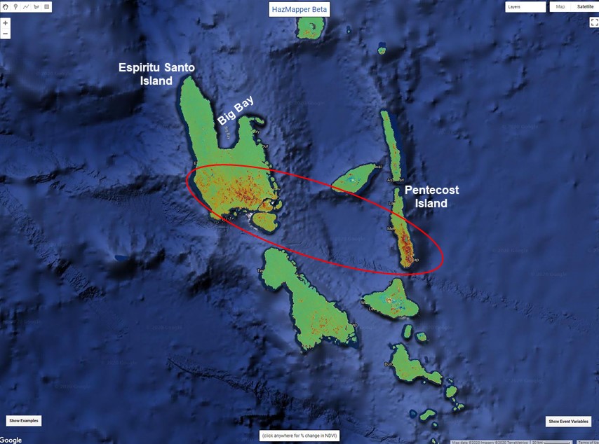
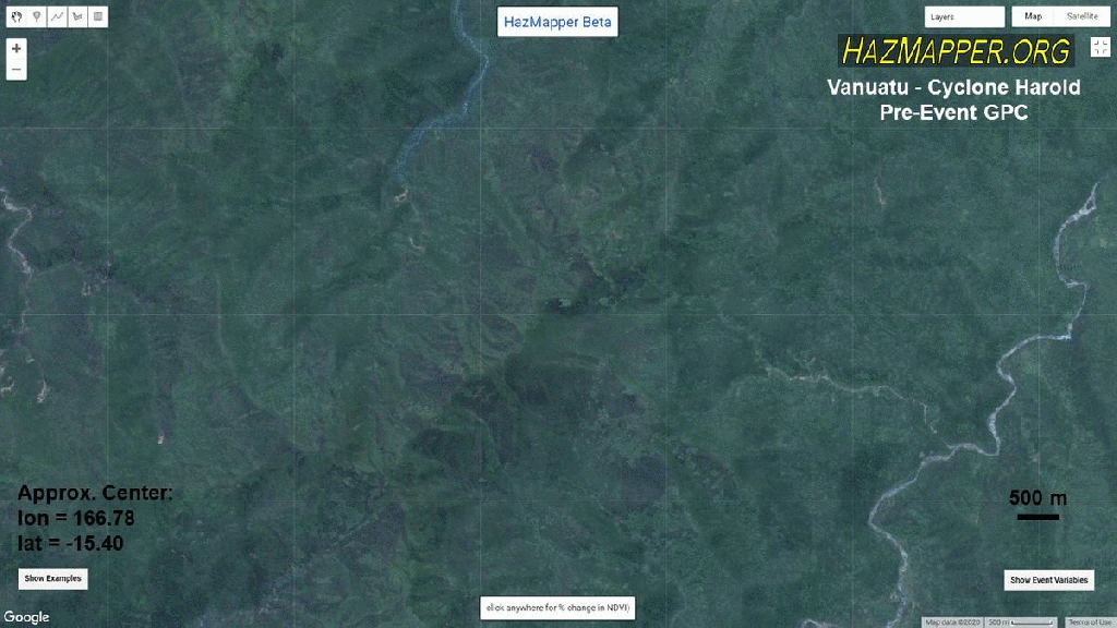
About a month later, we started picking up some cloud free Sentinel-2 imagery in HazMapper to check for damage. And damage did we find! The high tropical topography of Vanuatu, like many Pacific islands, holds significant cloud cover most of the year, so any cloud free imagery is exciting.
The first observation is how the passage of the cyclone contributed to significant defoliation and damage across the southern edge of Espiritu Santo and neighboring Pentecost Island to the southeast.
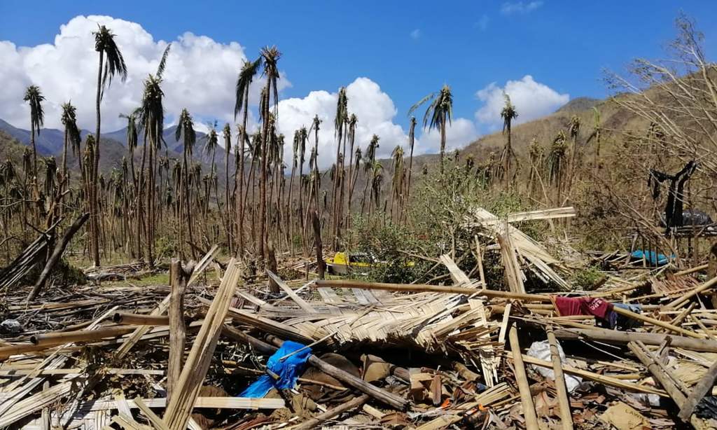
Zooming in, we can pick out this defoliation very clearly, but we also start to pick up what we suspect will amount to thousands of individual mass wasting events (landslides, debris flows, etc).
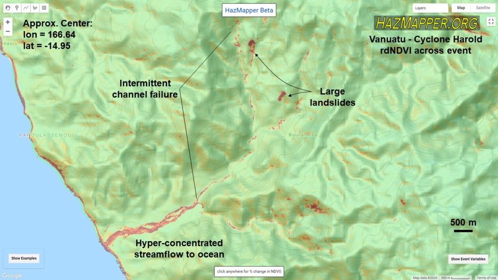
The damage is apparent at the landscape scale, covering the southwestern ~1/3 of the island. However, other parts of the island are not immune. Large debris flows and landslides are evident in the north as well:
Considering the untold number of hillslope failures on the interior of the islands, one must consider the affects of coastal sedimentation in a place so heavily dependent on its coastal ecosystems for food-source, cultural, tourism, and development reasons.
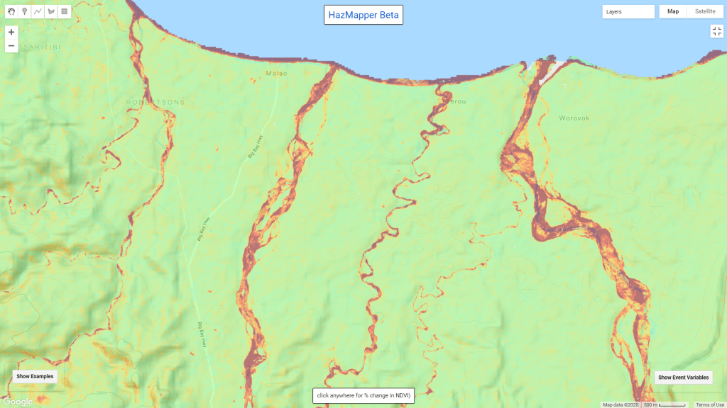
We can see the hyper-concentrated stream flows entering the ocean – the flooding removed enough riparian vegetation to make these beautifully braided channels visible in the rdNDVI data. Here’s an example of the mouth of several rivers on the northern edge of Espiritu Santo draining the high topography from the south into Big Bay.
It will be interesting to watch how this event could affect the hydrological cycle and future climate at Vanuatu. The idea that significant defoliation and increased sediment delivery to coastal margins will affect future conditions is not new – last year, Miller et al. reported on the effects from Hurricane Maria’s passage over Puerto Rico in 2017. They found decreased rainfall, increased runoff, increased nearshore turbidity, and a higher and thinner cloud base in the months following Maria. It would be consistent to expect the same of Vanuatu. Time will tell.
Interestingly, following the passage of Harold, Vanuatu was reporting zero cases of the novel Coronavirus and maintained its closed borders to keep the virus out of the country. This has made subsequent relief efforts difficult and assessments of the damage or loss of life are largely missing from the media. While the recovery from Harold has been hampered due to this, the country has reported that as of 20 May, 2020, there are still no confirmed cases of COVID-19 in the country.
