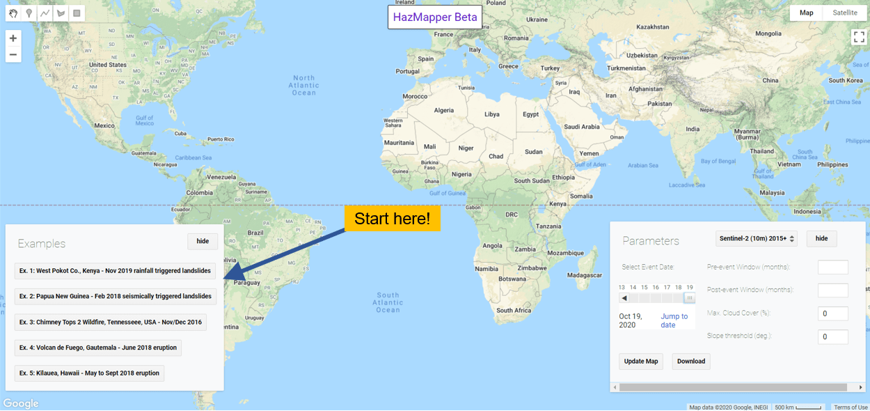
Very excited to announce we have opened HazMapper for the masses! We have been beta-testing the app and have had several researchers using the platform, including a class exercise in which 30 students used it to map landslides in the Philippines. For technical information about HazMapper and additional details on the app’s functionality and limitations,Continue reading “Hazblog-006: Release the HazMapper!”
Author Archives: cmscheip
HazBlog-005: Cyclone Harold, Defoliation, and Mass Wasting in Vanuatu
Steep topography, significant vegetation, and a category 4-5 tropical cyclone. This was the unfortunate reality for the people of Vanuatu on 6 April 2020. Vanuatu is an archipelago consisting of some 83 islands in the South Pacific. Checking out the imagery available on Google Earth will quickly show you the place is not a strangerContinue reading “HazBlog-005: Cyclone Harold, Defoliation, and Mass Wasting in Vanuatu”
HazBlog-004: Mapping Loss and Recovery of Canada’s Costliest Disaster – the 2016 Horse River Fire
Fort McMurray, Alberta. The numbers are staggering: 1,500,000 acres, 88,000 evacuees, 2,400 homes lost, $9.5 billion CAD in direct and indirect losses. The fire was detected May 1, 2016 in forest lands some 7 km southwest of Fort McMurray. Canadian officials understood severe fire conditions were present and had helicopter crews surveying the area whenContinue reading “HazBlog-004: Mapping Loss and Recovery of Canada’s Costliest Disaster – the 2016 Horse River Fire”
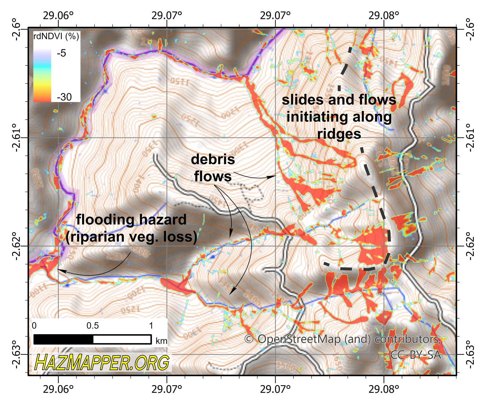
HazBlog-002: Mass Wasting in Burundi, December 2019
The HazMapper project was first envisioned and designed for locating mass wasting events in vegetated environments. We quickly realized that the Google Earth Engine application that we built can be used as a multi-hazard platform, as exemplified by the tornado-track example in our first post. Here we discuss the capabilities of HazMapper for its initialContinue reading “HazBlog-002: Mass Wasting in Burundi, December 2019”
HazBlog-001: Introduction and Easter Tornado Swarm – Southeast USA 2020
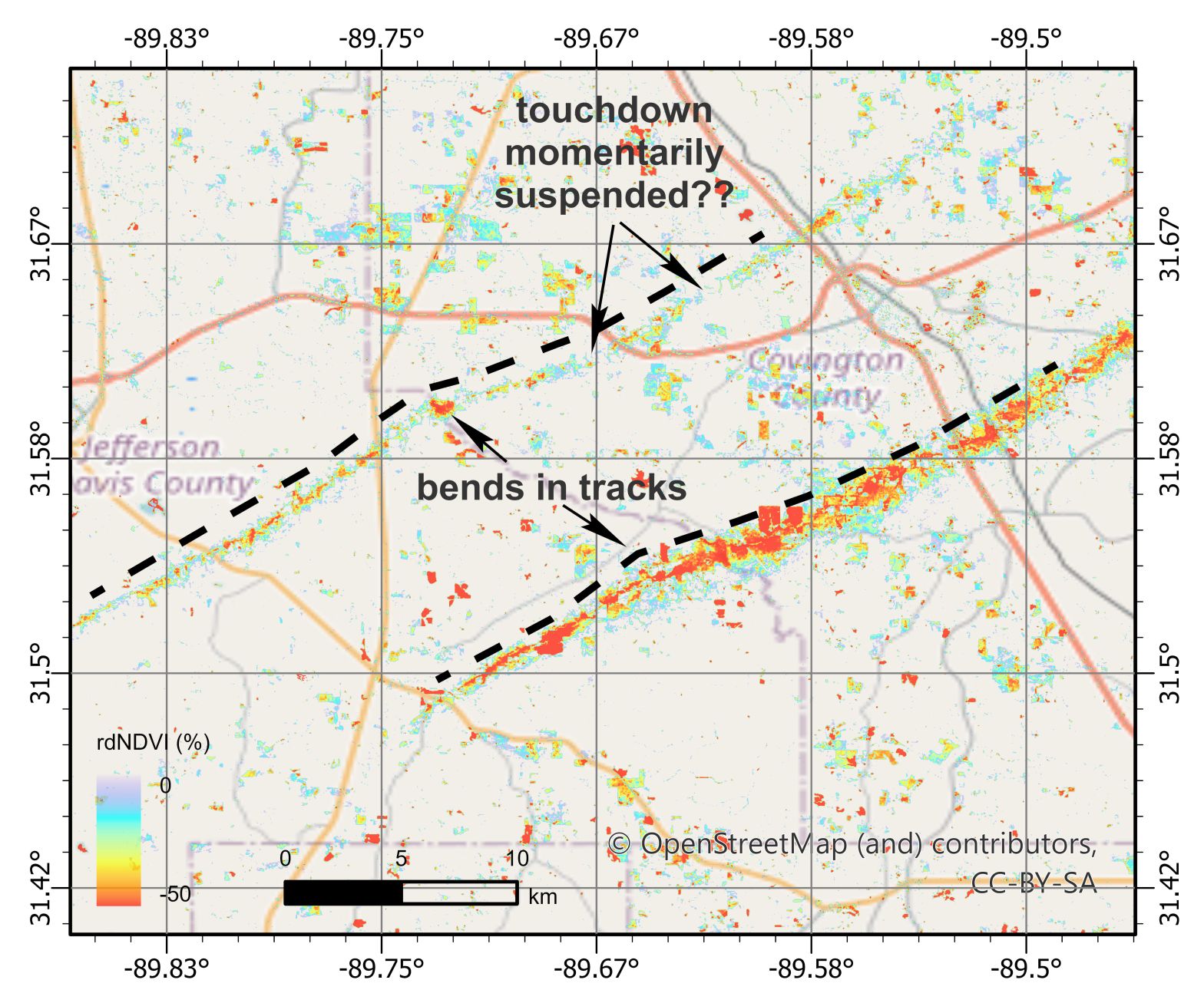
Welcome to the HazMapper Blog. This is where we will post short, timely summaries of recent natural disaster events from around the world utilizing the soon-to-be publicly available, open-source and web-based HazMapper Google Earth Application. A widespread tornado outbreak affected the southeastern US on Sunday and Monday, April 12-13, 2020 (Easter weekend). A strong atmosphericContinue reading “HazBlog-001: Introduction and Easter Tornado Swarm – Southeast USA 2020”
