Fort McMurray, Alberta. The numbers are staggering: 1,500,000 acres, 88,000 evacuees, 2,400 homes lost, $9.5 billion CAD in direct and indirect losses. The fire was detected May 1, 2016 in forest lands some 7 km southwest of Fort McMurray. Canadian officials understood severe fire conditions were present and had helicopter crews surveying the area whenContinue reading “HazBlog-004: Mapping Loss and Recovery of Canada’s Costliest Disaster – the 2016 Horse River Fire”
Tag Archives: north america
HazBlog-001: Introduction and Easter Tornado Swarm – Southeast USA 2020
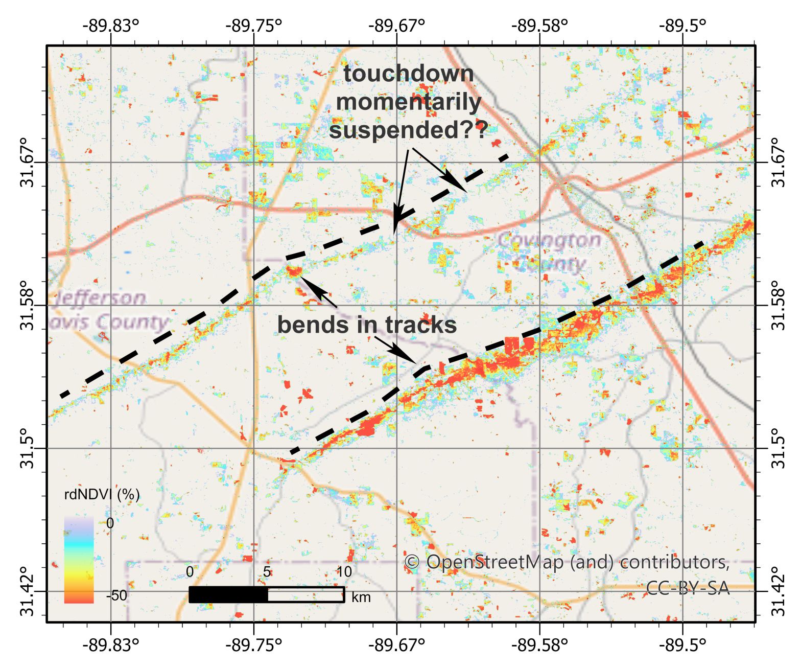
Welcome to the HazMapper Blog. This is where we will post short, timely summaries of recent natural disaster events from around the world utilizing the soon-to-be publicly available, open-source and web-based HazMapper Google Earth Application. A widespread tornado outbreak affected the southeastern US on Sunday and Monday, April 12-13, 2020 (Easter weekend). A strong atmosphericContinue reading “HazBlog-001: Introduction and Easter Tornado Swarm – Southeast USA 2020”
